Uploads by Hike395
Jump to navigation
Jump to search
For Hike395 (talk · contributions · Move log · block log · uploads · Abuse filter log)
This special page shows all uploaded files that have not been deleted; for those see the upload log.
| Date | Name | Thumbnail | Size | Description |
|---|---|---|---|---|
| 05:09, 9 September 2024 | North Fork Koyukuk Josh Spice.jpg (file) |  |
514 KB | Uploaded a work by Josh Spice, NPS from https://www.nps.gov/gaar/koyukukriver.htm with UploadWizard |
| 18:46, 8 September 2024 | Lake Scenes - California - DPLA - fc01fc021538065e9b91fffcab2c3321.jpg (file) |  |
951 KB | Cropped 32 % horizontally, 41 % vertically, 60 % areawise using CropTool with lossless mode. |
| 18:31, 8 September 2024 | Duck lake (2756427604).jpg (file) | .jpg) |
2.45 MB | Transferred from Flickr via #flickr2commons |
| 17:22, 8 September 2024 | Lake Mamie and Crystal Crag (51996781494).jpg (file) | .jpg) |
12.29 MB | Transferred from Flickr via #flickr2commons |
| 17:20, 8 September 2024 | Lake Mamie (3647912222).jpg (file) | .jpg) |
945 KB | Transferred from Flickr via #flickr2commons |
| 17:18, 8 September 2024 | Lake Mamie, California (9107061779).jpg (file) | .jpg) |
252 KB | Transferred from Flickr via #flickr2commons |
| 16:36, 8 September 2024 | Eastern Sierra Scenic Byway sign detilt.jpg (file) |  |
1.23 MB | == {{int:filedesc}} == {{Information |Description={{en|1=Eastern Sierra Scenic Byway sign on U.S. Route 395, California}} |Source={{Derived from|Eastern Sierra Scenic Byway California United States route 395.jpg|display=50}} |Date=2024-09-08 16:35 (UTC) |Author=* File:Eastern Sierra Scenic Byway California United States route 395.jpg: Jengod * Detilt: [[User:{{subst:REVISIONUSER}}|{{subst:REVISIONUSER... |
| 11:41, 8 September 2024 | Top of Mammoth ski area.jpg (file) |  |
10.17 MB | {{Information |Description=Top of Mammoth Mountain Ski Area |Source=File:Mammoth Mountain ski area, Mammoth Lakes, California LCCN2013633630.tif {{LOC-image|id=highsm.23173}} |Date={{Taken on|2012-11-15 14:57|location=United States}} |Author={{Creator:Carol M. Highsmith}} |Permission= |other_versions= }} =={{int:license-header}}== Original file: {{PD-Highsmith}} Conversion to jpg: {{cc0}} Category:Mammoth Mountain Ski Area |
| 11:13, 8 September 2024 | Snowboarder at Mammoth.jpg (file) |  |
6.96 MB | {{Information |Description=Snowboard at Mammoth Mountain Ski Area |Source=File:Snowboarder, Mammoth Lakes, California LCCN2013633653.tif |Date={{Taken on|2012-11-15}} |Author={{Creator:Carol M. Highsmith}} |Permission={{LOC-image|id=highsm.23196}} |other_versions= }} =={{int:license-header}}== Original: {{PD-Highsmith}} Conversion to jpg: {{cc0}} Category:Mammoth Mountain Ski Area |
| 03:50, 8 September 2024 | Swall Meadows from Open Street Map.gif (file) |  |
101 KB | == {{int:filedesc}} == {{Information |Description={{en|1=Street map of Swall Meadows community, Mono County, California. Adapted from Open Street Map.}} |date=2014-12-30 |Source={{Derived from|Swall Meadows from Open Street Map.png|display=50}} |Date=2024-09-08 03:48 (UTC) |Author=* File:Swall Meadows from Open Street Map.png: Open Street Map contributors; adapted by Dcrjsr * Conversion to gif: [[User:{{subst:REVISIONUSER}}|{{subst:REVISIONUSER... |
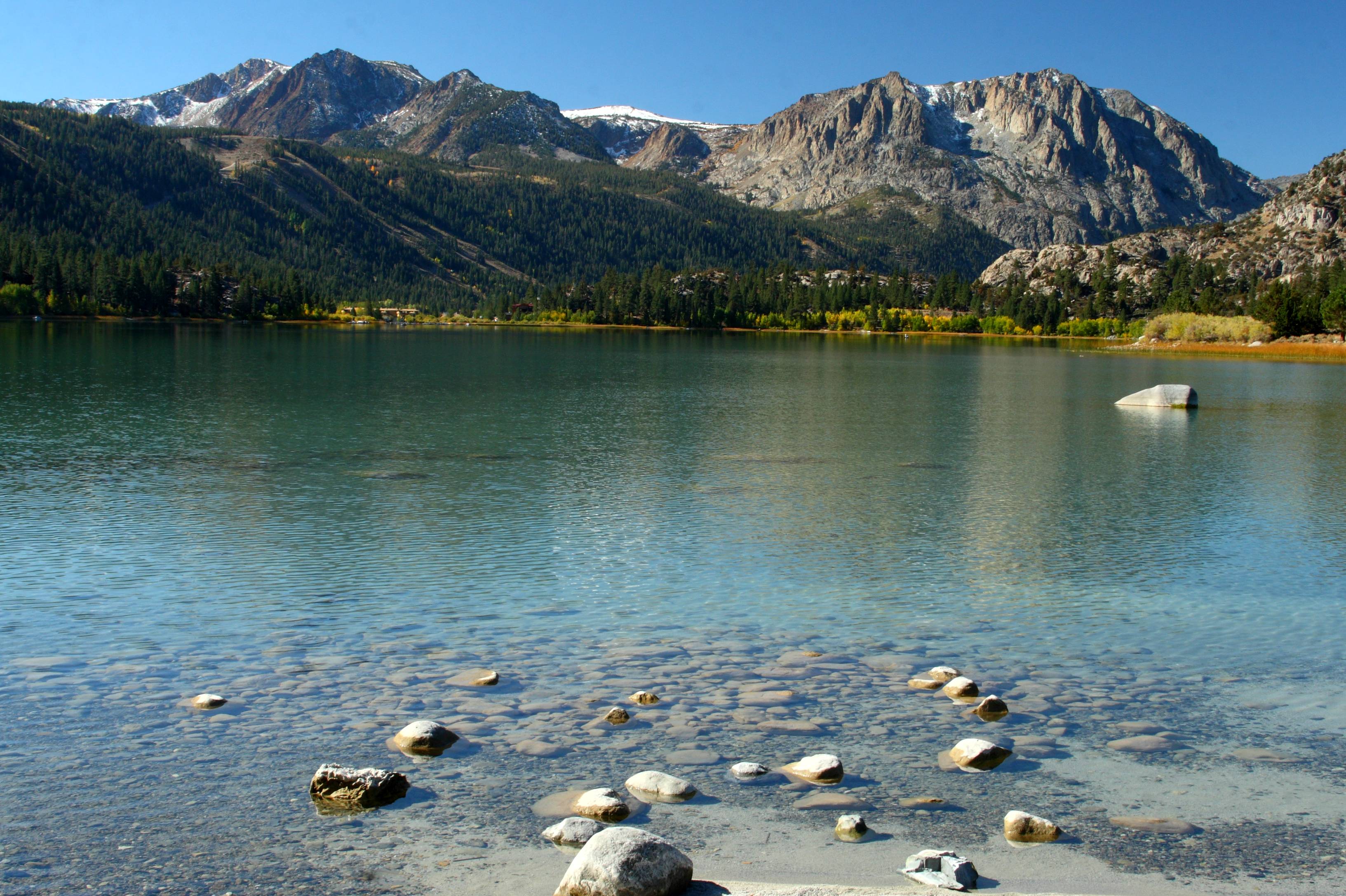
| 13:19, 6 September 2024 | June Lake with Sierra crest.jpg (file) |  |
1.89 MB | remove tilt |
| 13:12, 6 September 2024 | JUNE LAKE, California.JPG (file) |  |
1.15 MB | remove tilt, remove lens dirt |
| 16:39, 31 August 2024 | MtLyell.jpg (file) |  |
141 KB | enlarge and sharpen using standard GIMP tools |
| 07:14, 27 August 2024 | Noun Project Technology icon 2034212.svg (file) | 5 KB | minify with svgomg | |
| 14:38, 26 August 2024 | 2020 Creek Fire map.gif (file) |  |
526 KB | == {{int:filedesc}} == {{Information |Description={{en|1=The Creek Fire burned more than 370,000 acres in Fresno and Madera counties in California in 2020. It destroyed more than 800 structures. As of 2023, it was the fifth-largest wildfire in recorded state history. This image was made in QGIS using data from the California Department of Forestry and Fire Protection (Cal Fire), the National Hydrography Dataset (NHD), OpenStreetMap, and others.}} |date=2023-11-05 |Source={{Derived from|2020 C... |
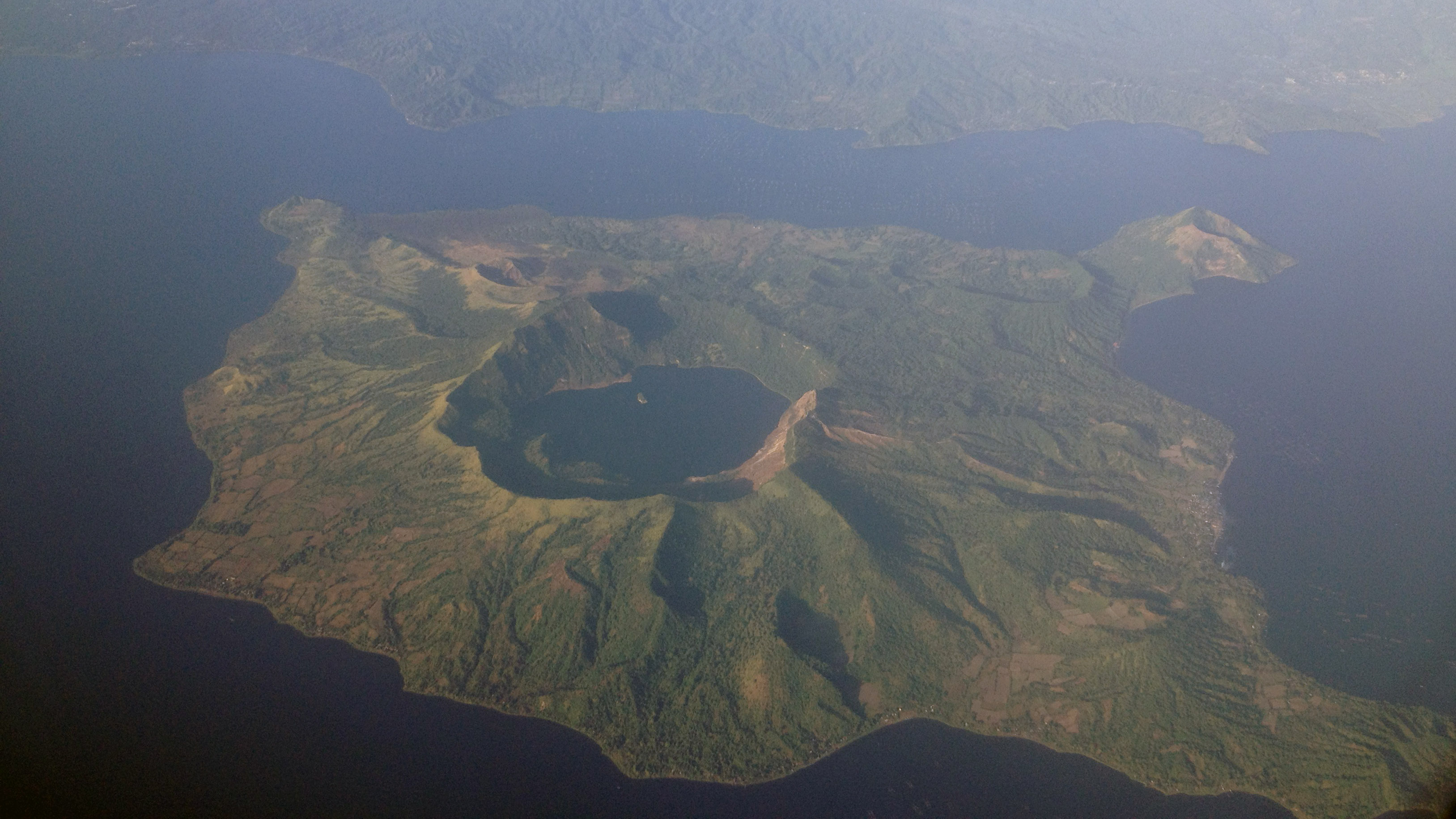
| 15:10, 24 August 2024 | Taal Volcano aerial 2013.jpg (file) |  |
1.36 MB | brighten, sharpen |
| 14:55, 24 August 2024 | Taal Lightning Strike During Eruption (retouched).jpg (file) | .jpg) |
842 KB | {{Information |Description={{en|{{w|Volcanic lightning}} in an eruption of {{w|Taal Volcano}} in the Philippines}} |Source=original image |Date= 2024-08-24 |Author= Original image: {{User|Etrhamjr}}, Retouching: {{User|Hike395}} |Permission= {{cc-by-sa-4.0}} |other_versions={{Retouched picture|arm and cellphone removed|editor=Hike395|orig=Taal_Lightning_Strike_During_Eruption.jpg}} }} [[Category:Taal Volcano - lightning strikes during eru... |
| 00:54, 22 August 2024 | Lake chad shore (detilt).jpg (file) | .jpg) |
1.81 MB | == {{int:filedesc}} == {{Information |Description={{en|1=Image of the opposite shore at the mouth of the lake chad}} |date=2017-12-23 15:11:51 |Source={{Derived from|Lake chad shore.jpg|display=50}} |Date=2024-08-22 00:53 (UTC) |Author=* File:Lake chad shore.jpg: Coolthoom1 * Detilt: [[User:{{subst:REVISIONUSER}}|{{subst:REVISIONUSER}}]] |Permission= |other_versions= }} == {{int:license-header}} == Original: {{self|Cc-by-sa-4.0|author={{User... |
| 22:08, 21 August 2024 | Mare d'Ounsolo ou N'Solo de Téra (detilt).jpg (file) | .jpg) |
798 KB | less aggressive detilting |
| 04:04, 18 August 2024 | Park fire 2024-08-14.gif (file) |  |
5.87 MB | == {{int:filedesc}} == {{Information |Description={{en|1=This map shows the footprint of the 2024 Park Fire, which has burned more than 390,000 acres in Butte and Tehama counties in Northern California. The fire, which is the fifth largest in California state history, was caused by arson. It has destroyed at least 437 structures but has caused no fatalities. This map was made in QGIS using data from the California Department of Forestry and Fire Protection (Cal Fire), the United States Geolog... |
| 20:57, 13 August 2024 | Park Fire 2024-08-08.gif (file) |  |
5.84 MB | == {{int:filedesc}} == {{Information |Description={{en|1=This map shows the footprint of the 2024 Park Fire, which has burned more than 390,000 acres in Butte and Tehama counties in Northern California. The fire, which is the fifth largest in California state history, was caused by arson. It has destroyed at least 437 structures but has caused no fatalities. This map was made in QGIS using data from the California Department of Forestry and Fire Protection (Cal Fire), the United States Geolog... |
| 14:07, 14 July 2024 | Ecoregion AA1104.svg (file) |  |
146 KB | thicker red box |
| 13:38, 14 July 2024 | The Southern Ocean and Antarctica.svg (file) |  |
146 KB | rm stray, minify |
| 07:05, 10 July 2024 | Naval Stores - Georgia - DPLA - 84fa3caae841a98c9410511d462d85a0.jpg (file) |  |
1.18 MB | Cropped 37 % horizontally, 46 % vertically, 66 % areawise using CropTool with lossless mode. |
| 06:52, 10 July 2024 | Along the Naches Trail above junction with the Gold Hill Trail, August 1913 (CURTIS 815).jpeg (file) | .jpeg) |
85 KB | Cropped 38 % horizontally, 38 % areawise using CropTool with lossless mode. |
| 06:50, 10 July 2024 | A tall date palm on the corner of Washington Street and Figueroa Street, Los Angeles, ca.1920 (CHS-2376).jpg (file) | .jpg) |
997 KB | Cropped 8 % horizontally, 8 % vertically, 16 % areawise using CropTool with lossless mode. |
| 06:45, 10 July 2024 | "Gladys & Jeanette Mt. Holyoke" (3793658702).jpg (file) | .jpg) |
278 KB | Cropped 7 % horizontally, 7 % vertically, 14 % areawise using CropTool with lossless mode. |
| 06:43, 10 July 2024 | 4-64. Anchorage - Shows savage destruction in Turnagain (29795575644).jpg (file) | .jpg) |
7.81 MB | Cropped 6 % horizontally, 10 % vertically, 15 % areawise using CropTool with lossless mode. |
| 06:41, 10 July 2024 | 1920. Close up view of brush burning - on Yellow Pine Timber Sale - Eccles Timber Sale. Whitman National Forest, Oregon. (39756362740).jpg (file) | .jpg) |
450 KB | Cropped 31 % horizontally, 47 % vertically, 63 % areawise using CropTool with lossless mode. |
| 00:38, 20 June 2024 | Jose Lewis, Papago (cropped).jpg (file) | .jpg) |
963 KB | == {{int:filedesc}} == {{Information |Description=Jose Lewis, Papago |Source= {{Derived from|Jose Lewis, Papago - NARA - 523813.tif|display=50}} ([https://catalog.archives.gov/id/523813 original source]) |Date=between circa 1871 and circa 1907 |Author=Smithsonian Institution. Bureau of American Ethnology. |Permission= |other_versions=original }} == {{int:license-header}} == Original: {{PD-USGov}} Cropping and rotation: {{cc0}} == {{Original... |
| 04:29, 6 June 2024 | Ecoregions of San Francisco Bay Area.gif (file) |  |
146 KB | == {{int:filedesc}} == {{Information |Description=Ecoregions of the San Francisco Bay Area |Source={{Derived from|Ecoregions of San Francisco Bay Area.png|display=50}} |Date=2024-06-06 04:28 (UTC) |Author=* File:Ecoregions of San Francisco Bay Area.png: Griffith, G.E., Omernik, J.M., Smith, D.W., Cook, T.D., Tallyn, E., Moseley, K., and Johnson, C.B. * Conversion to gif: [[User:{{subst:REVISIONUSER}}|{{subst:REVISIONUSER}}]] |Permission= |oth... |
| 22:20, 5 June 2024 | Level IV ecoregions, Coast Range.gif (file) |  |
230 KB | == {{int:filedesc}} == {{Information |Description={{en|1=Level IV ecoregions in the Coast Range ecoregion, as defined by the EPA. This map is a draft and may now be slightly outdated. For more information about these ecoregions, see [http://www.epa.gov/wed/pages/ecoregions.htm]. Note: Sections of the Coast Range ecoregion in California have not been mapped yet.}} |Source={{Derived from|Level IV ecoregions, Coast Range.png|display=50}} |Date=2024-06-05 21:21 (UTC) |Author=* [[:File:Level IV ec... |
| 21:15, 5 June 2024 | Coast Range ecoregion California.gif (file) |  |
276 KB | == {{int:filedesc}} == {{Information |Description=Map of Coast Range ecoregion (1) as defined by the US Environmental Protection Agency |Source={{Derived from|Coast Range ecoregion California.png|display=50}} |Date=2024-06-05 21:15 (UTC) |Author=* File:Coast Range ecoregion California.png: Griffith, G.E., Omernik, J.M., Smith, D.W., Cook, T.D., Tallyn, E., Moseley, K., and Johnson, C.B. * conversion to gif: [[User:{{subst:REVISIONUSER}}|{{subst:R... |
| 23:02, 2 June 2024 | Ecoregions of San Francisco Bay Area.png (file) |  |
506 KB | {{Information |Description=Ecoregions of the San Francisco Bay Area |Source=https://gaftp.epa.gov/EPADataCommons/ORD/Ecoregions/ca/CA_eco_front_ofr20161021_sheet1.pdf |Date=2016 |Author=Griffith, G.E., Omernik, J.M., Smith, D.W., Cook, T.D., Tallyn, E., Moseley, K., and Johnson, C.B. |Permission={{PD-USGov-EPA}} |other_versions= }} Category:EPA ecoregion maps of California |
| 21:37, 2 June 2024 | Coast Range ecoregion California.png (file) |  |
979 KB | {{Information |Description=Map of Coast Range ecoregion (1) as defined by the US Environmental Protection Agency |Source=https://gaftp.epa.gov/EPADataCommons/ORD/Ecoregions/ca/CA_eco_front_ofr20161021_sheet1.pdf |Date=2016 |Author=Griffith, G.E., Omernik, J.M., Smith, D.W., Cook, T.D., Tallyn, E., Moseley, K., and Johnson, C.B. |Permission={{PD-USGov-EPA}} |other_versions= }} Category:EPA ecoregion maps of California |
| 13:31, 1 June 2024 | Mt Cook, NZ.jpg (file) |  |
4.51 MB | remove haze |
| 02:27, 27 May 2024 | Kala Patthar and Pumori from Gorak Shep.jpg (file) |  |
2.15 MB | Copied photo from Flickr using Flickypedia |
| 18:42, 25 May 2024 | Antarctilamna ultima.gif (file) |  |
343 KB | == {{int:filedesc}} == {{Information |Description={{en|1=Devonian shark Antarctilamna ultima from Late Devonian of South Africa}} |date=2015-08-10 |Source={{Derived from|Antarctilamna ultima.jpg|display=50}} |Date=2024-05-25 18:41 (UTC) |Author=* File:Antarctilamna ultima.jpg: DiBgd * conversion to gif: [[User:{{subst:REVISIONUSER}}|{{subst:REVISIONUSER}}]] |Permission= |other_versions= }} == {{int:license-header}} == Original: {{Cc-by-sa-4.0... |
| 18:32, 25 May 2024 | Antarctilamna ultima.jpg (file) |  |
3.79 MB | File:Antarctilamna speciesDB15.jpg cropped 8 % horizontally, 48 % vertically, 52 % areawise using CropTool with lossless mode. |
| 13:03, 23 May 2024 | Harris's Hawk (cropped).jpg (file) | .jpg) |
624 KB | File:Harris's Hawk (Parabuteo unicinctus) on the road to Mezquital, Municipality of Matamoros, Tamaulipas, Mexico (18 March 2009).jpg cropped 34 % horizontally, 21 % vertically, 47 % areawise using CropTool with lossless mode. |
| 02:20, 23 May 2024 | Twenty.svg (file) |  |
751 bytes | {{Information |Description=Number 20 |Source={{own}} |Date=2024-05-22 |Author={{User|Hike395}} |Permission={{cc0}} |other_versions= }} Category:20 (number) |
| 00:43, 23 May 2024 | Terrestrial ecoregions USA CAN MEX.svg (file) |  |
696 KB | minify with svgomg |
| 00:40, 23 May 2024 | Great Basin Montane Forests map.svg (file) |  |
181 KB | minify with svgomg |
| 05:28, 22 May 2024 | Bouldert.jpg (file) |  |
903 KB | remove date watermark |
| 05:20, 22 May 2024 | Eastonterm.jpg (file) |  |
940 KB | remove watermark instead of cropping |
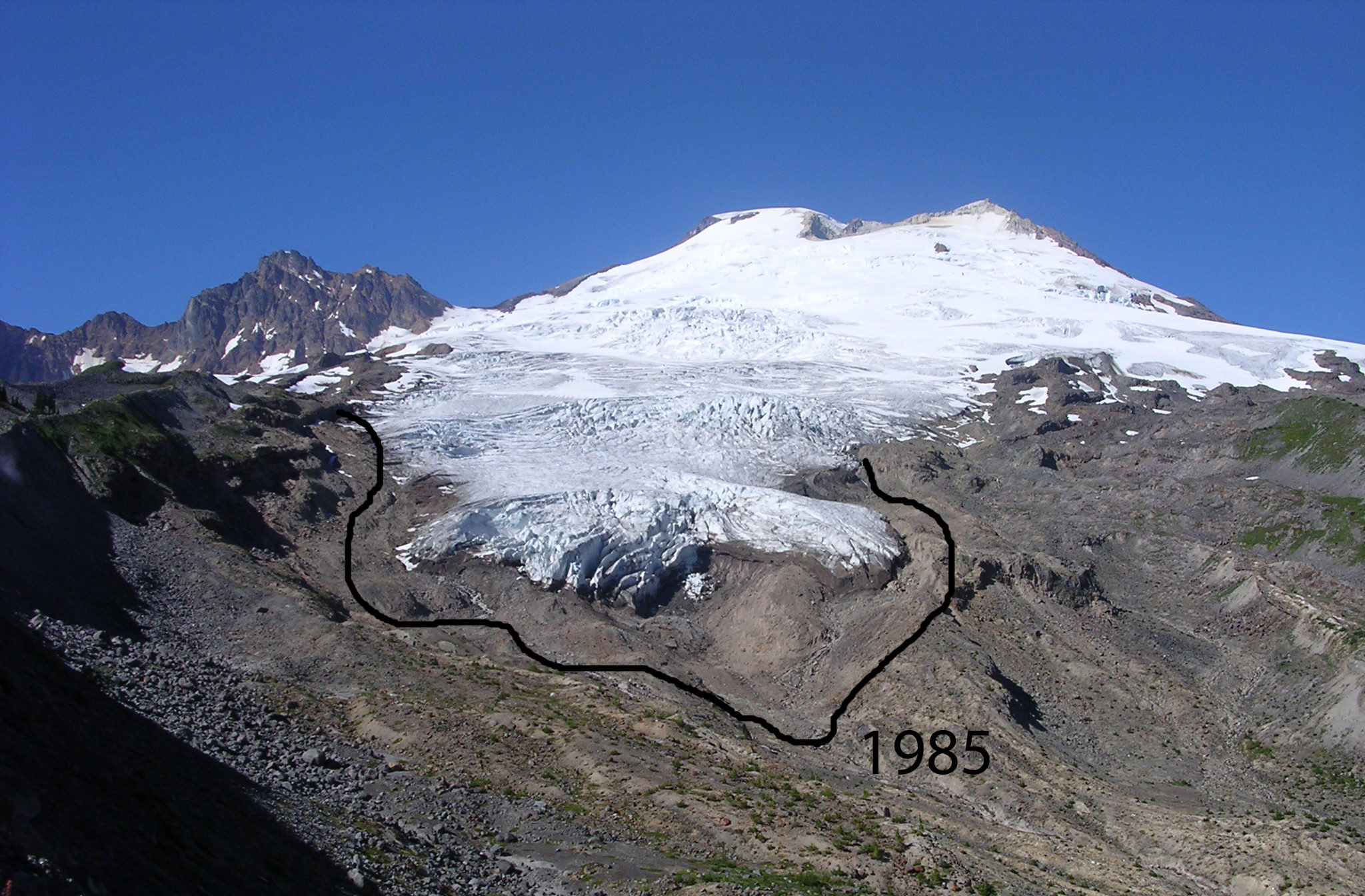
| 05:07, 22 May 2024 | Mt. Adams Glacier.JPG (file) |  |
1.21 MB | remove text |
| 04:49, 22 May 2024 | Taylor Creek Beaver Dam, 11-25-13.JPG (file) |  |
4.8 MB | remove rather than crop watermark |
| 04:40, 22 May 2024 | Taylor Creek Beaver Dam, 12-11-13.JPG (file) |  |
2.56 MB | remove rather than crop watermark |
| 04:32, 22 May 2024 | Taylor Creek Dam site, 12-12-13.JPG (file) |  |
1.96 MB | remove rather than crop watermark |
| 04:11, 22 May 2024 | Mount McLoughlin.jpg (file) |  |
126 KB | remove watermark instead of cropping |
.jpg)
.jpg)
.jpg)
.jpg)
.jpg)
.jpg)
.jpg)
.jpeg)
.jpg)
.jpg)
.jpg)
.jpg)
.jpg)
.jpg)
_on_the_road_to_Mezquital,_Municipality_of_Matamoros,_Tamaulipas,_Mexico_(18_March_2009).jpg)